Ex Fair of Rome
- ARCHITECTURE, URBAN DESIGN
Ex Fair of Rome
Project: Nemesi Architects with Leaf (landscape), Open Impact (ESG sustainability), Daniel Modigliani and Claudio Rosi (urban planning strategies), Stefano Giovenali (mobility strategies)
Typology: Urban Master Plan
Year: 2024
Location: Rome
Area: 76,700 sqm
Programme: 44,360 sqm for residences, offices, and co-working spaces
Services: International design competition

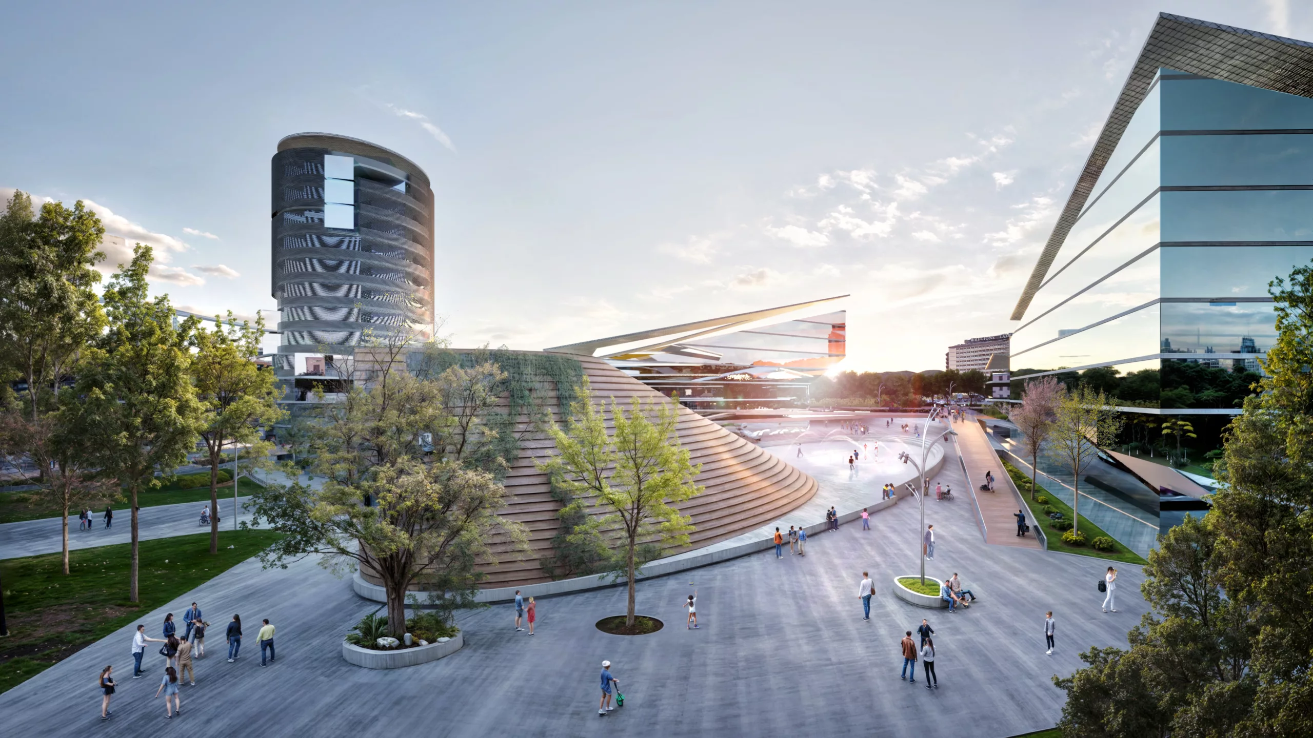
The project is located in a multifunctional neighbourhood of Rome with exceptional characteristics, because it is part of one of the few systems of modern Rome designed also with different functions of urban rank, and because it belongs to a very rich environmental landscape system that is in the process of being developed, which runs along the large Appia Antica park and is adjacent to the Tormarancia Park.
The project lot has a very close relationship with both EUR (the modern city) and the historical centre, thanks to the Cristoforo Colombo axis.
The objective of the Master plan is to work on the urban organisation aimed at the design of an integrated and innovative district, capable of generating urban quality and social cohesion.
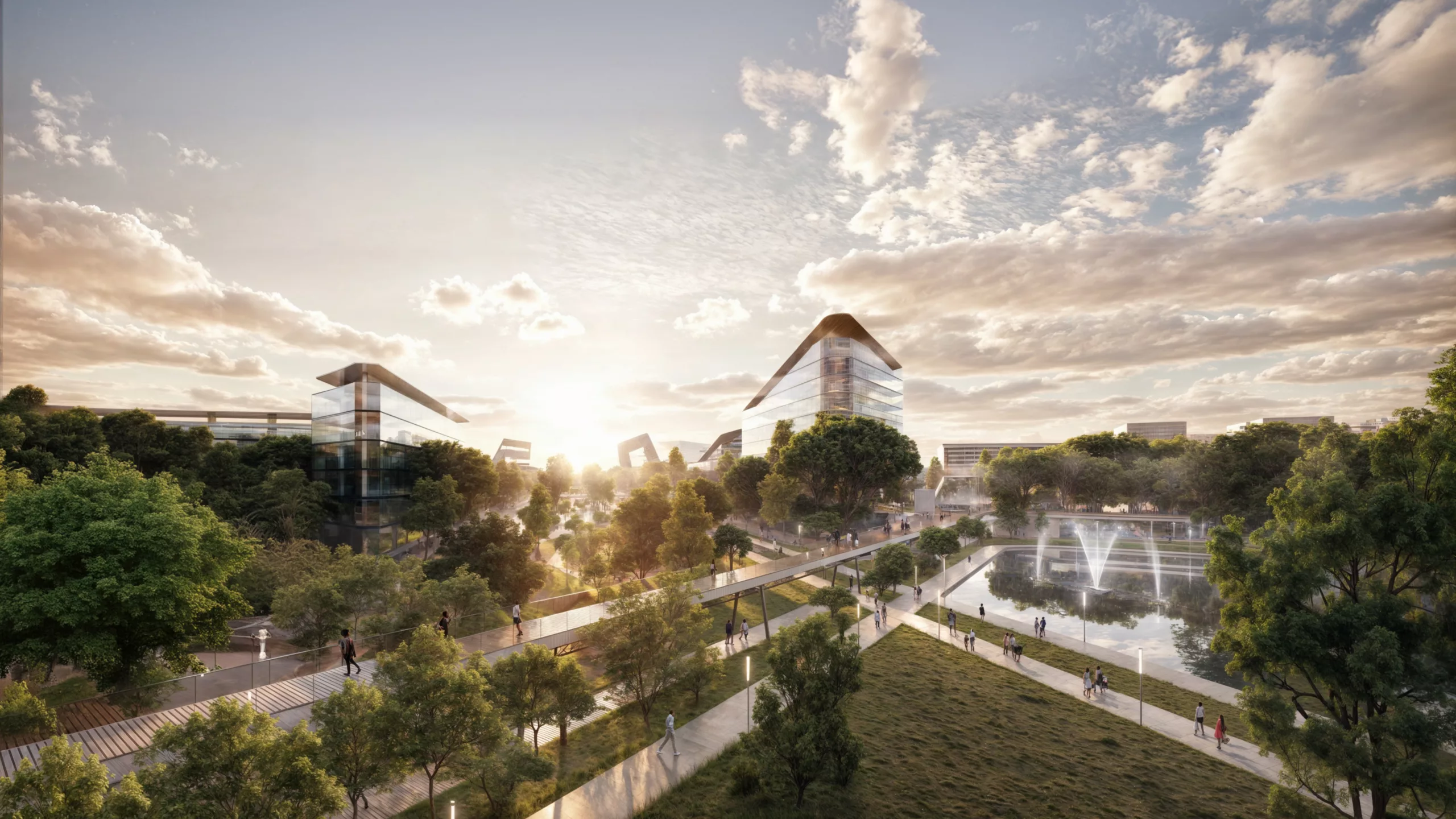
The peculiarity of the project lies in the possibility of joint and integrated valorisation between architecture and landscape, public and private dimensions, from whose dialogue and confrontation the overall design of the Master Plan is generated. The proposal gives shape to a new neighbourhood made of intrinsic and extrinsic relations, where a contemporary urban fabric dialogues with the landscape and the existing city, building new systems of relationships.

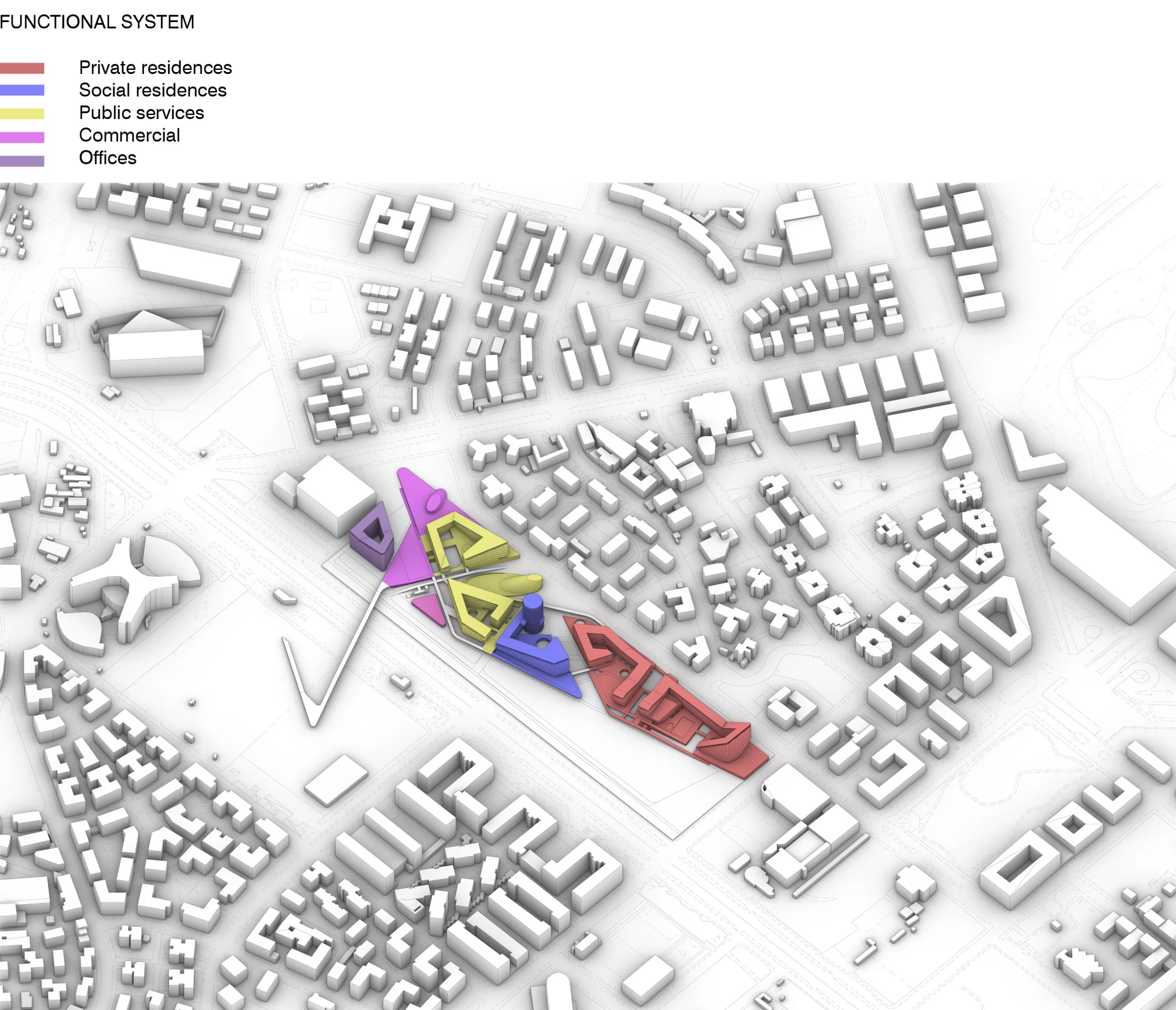
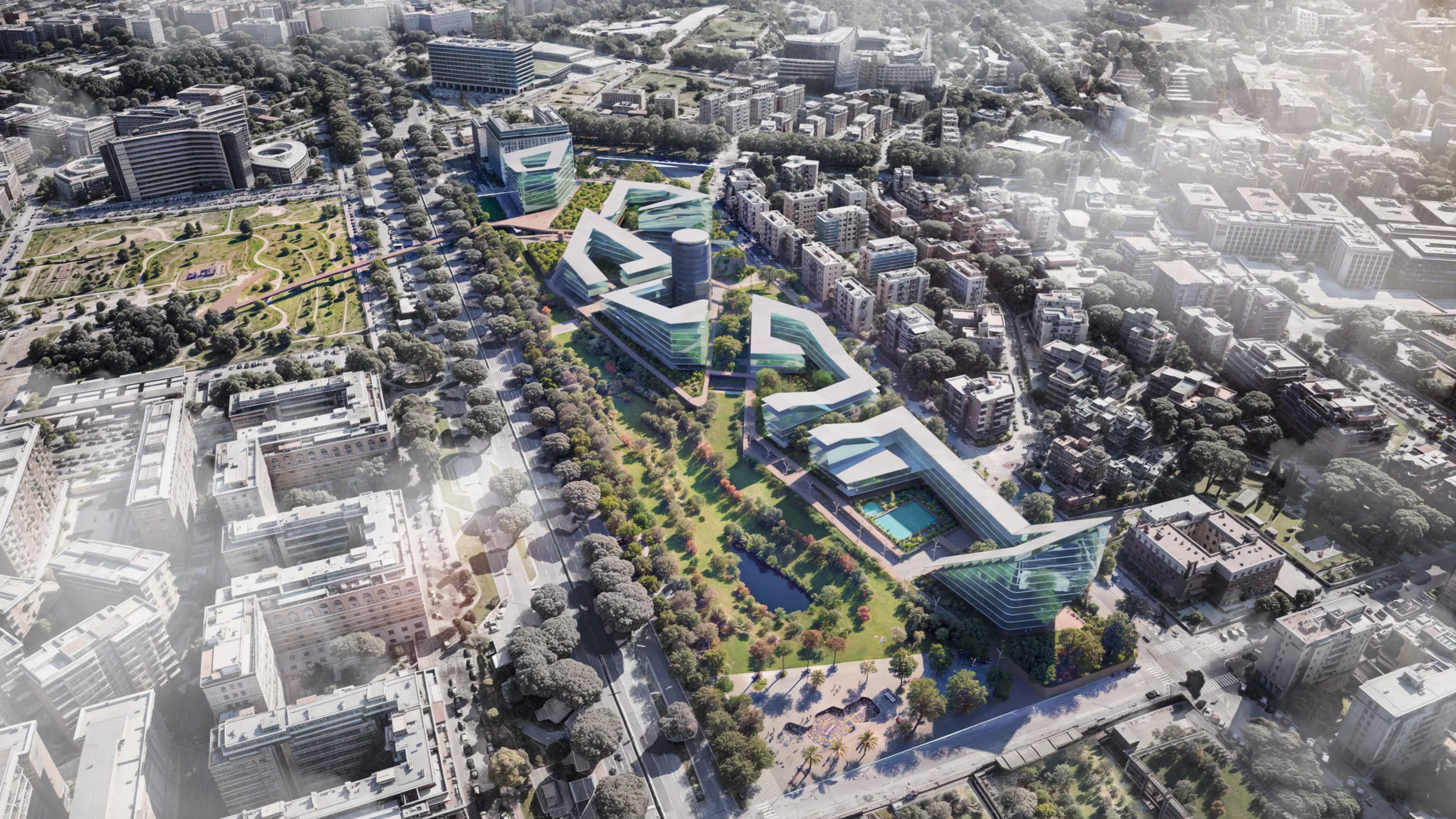
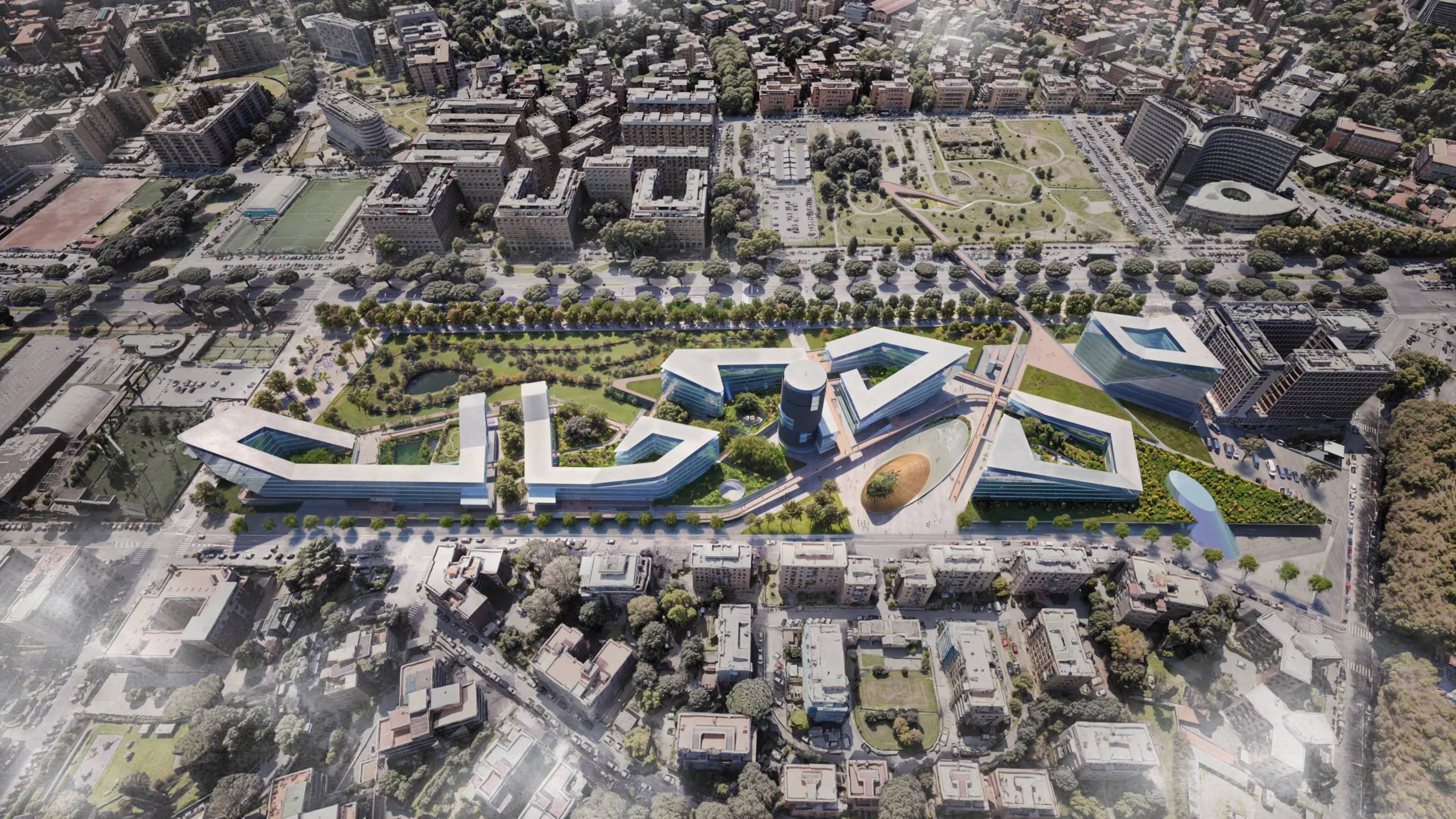
From an organisational point of view, the master plan is organised in 5 functional compartments, facing a large park occupying the entire longitudinal strip of the project lot, which separates the new building from Via Cristoforo Colombo.
The large equipped park is the generating element of the project, around which the public and private functions are organised. The diagonal shape of the park is designed to widen from north to south, thus immersing the residences in greenery and separating them from the large road system. All the functions of the Master Plan, however, overlook the large park, and are organised in 5 building sections, articulated from south to north of the project lot, in sequence
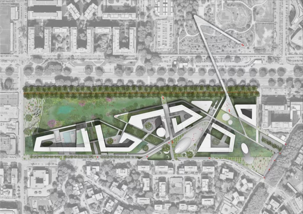
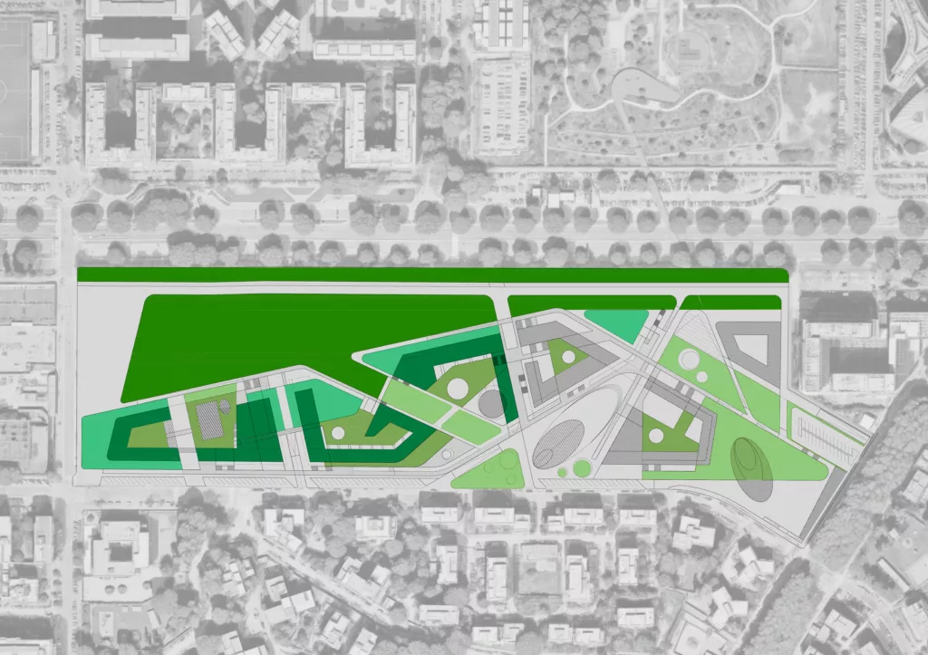
The project draws ‘urban diagonals’, since the overall layout of the Master Plan is set on geometries based on the intersection of two diagonals: those that define the main systems that characterise the Master Plan:
- The system of the large equipped green park and public spaces
- The system of residences
- The system of public services
- The system of private services
In the project area, the design of several diagonals builds the system of relations between private and public places, giving shape to a rich and articulated urban texture, just like the fabric of Rome. The diagonal is also often associated with movement and play, an aspect that in this project is emphasised in the design of the public space and related functions, to give shape to the idea of a children’s city that is part of the vocation of this area.
The characteristic rectangle shape of the project lot is then broken down into sectors that house the main systems identified by the functional programme. In turn, within these sectors are organised the related sub-systems (offices, training spaces, workshops, commerce, etc.), as well as the design of the public space and landscape.
The dynamism of the diagonal geometries thus becomes a generating element of interconnected functional and urban systems, and becomes the premise on which to identify the generative lines of the large public park and residences, inspired by the morphology of the most innovative urban complexes realised in recent years, including, for example, the Big House Complex in Copenhagen.
The main pedestrian routes in the area are also set on diagonal lines, as is the design of the private and public green spaces that enrich the residences, organised on the idea of an open courtyard building, evoking the traditional theme of the courtyard and reinterpreting it in a contemporary key. The project’s perspective views are also based on this geometry, connecting the residences and services to the landscape design, revealing a multiplicity of viewpoints and a unique compositional richness.
The residences themselves, although conceived to have a rational and modular distribution logic, on an orthogonal grid, are characterised in some parts of the elevation by diagonal sections of the related buildings, which determine the terraces on all levels, increasing their consequent value.
The diagonal evokes the idea of a city on the move, oriented towards the future and towards young people, who in the Master Plan will be the protagonists thanks to the public services dedicated to them, and also to the design of the public spaces that will make this district a point of attraction at an urban level.
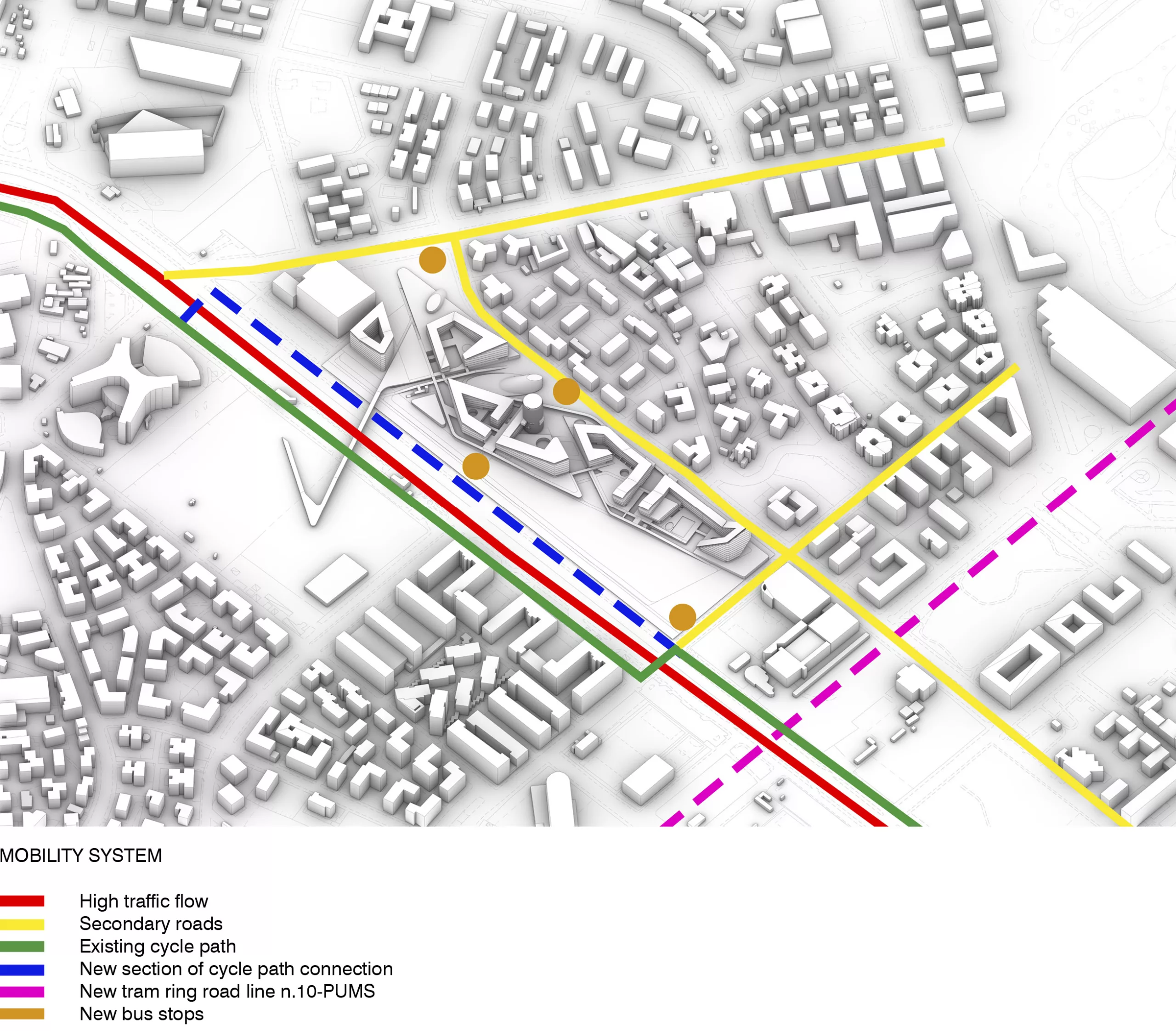
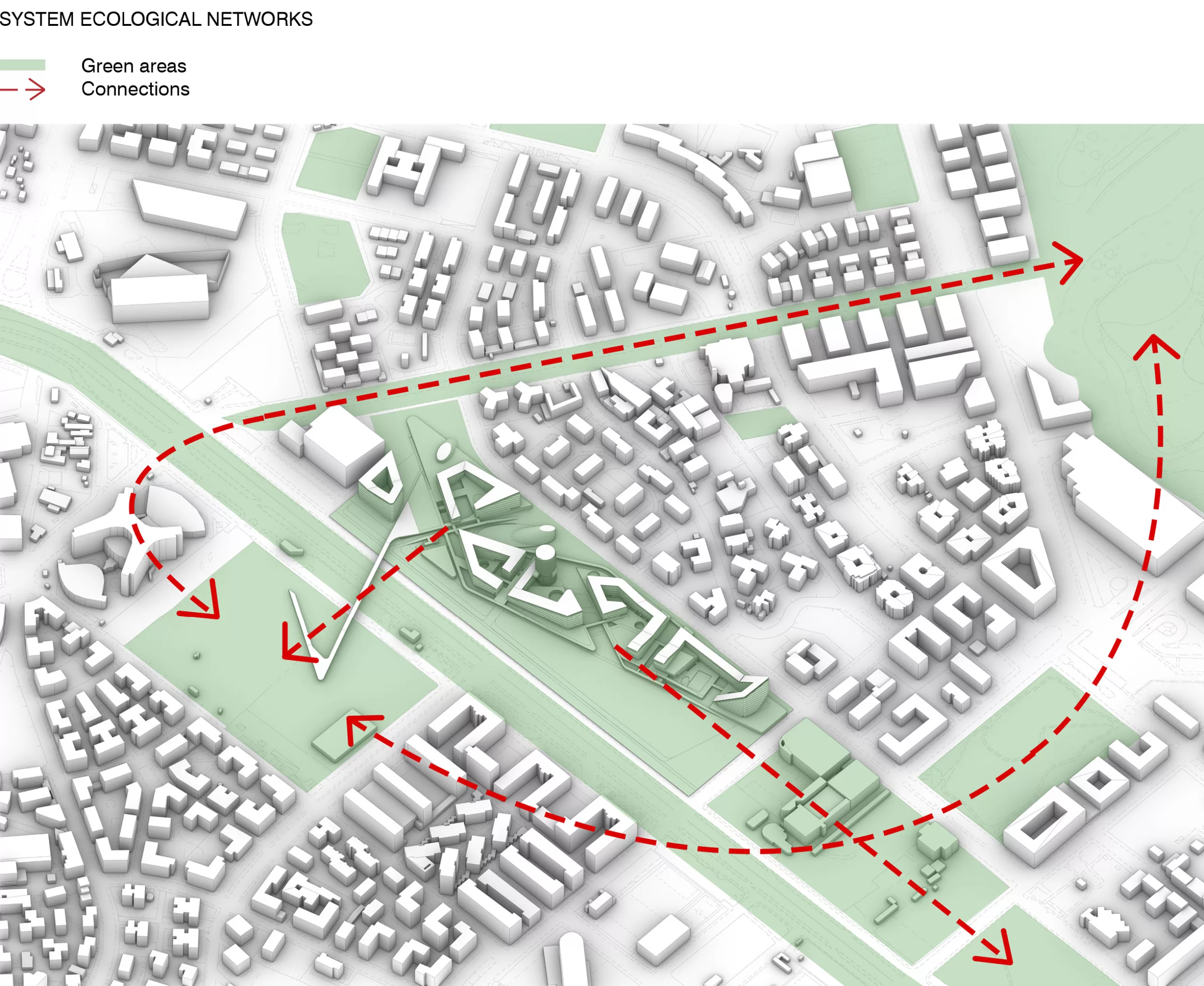

The large public park is the heart of the project and is conceived as a natural oasis, where people will be able to enjoy moments of relaxation and recreation, and carry out outdoor activities, in close connection with the urban functions established on the lot. The park has a soft elevation, typical of the Roman countryside, recalling in this sense the great parks of Rome, from the Appian Way to Villa Borghese.
On the Via Cristoforo Colombo frontage, the park is screened by tall trees, defining a protected urban backdrop, while towards Via dell’Arcadia green tree-lined and paved paths radiate, connecting to the residences and other functions. The plano-altimetrical articulation of the park is rich so as to connect the different heights of the lot and mediate the relationship with the residences. The same green courtyards inside the residences represent an extension of the park in a more protected and intimate dimension.
The project then articulates a hierarchy of public, semi-public and private spaces, which together contribute to the design of the outdoor spaces; these spaces are closely connected to the overall geometry of the project, and in particular to the residences and public services.
The landscape articulation of the project also includes the green terraces of the courtyard residences, contributing to the three-dimensional connotation of the landscape work in the project.
The specificity of the project and its sustainability are linked to its ability to build a full urban, landscape and social integration with respect to the reference context. For this reason, a preliminary analysis of the project’s Social Return of Investment (SROI) was carried out, according to the most innovative methodologies on the market today, based on its qualitative and quantitative characteristics.
The project focuses on the construction and representation, with respect to the areas of analysis identified and co-designed, of the project’s value chain, defined as the ‘Chain of Impacts’, which provides an initial evidence of the change generated by the project’s activities and outputs and also makes it possible to read this change according to different scales – person, community, society – also highlighting the different but integrated nature of its constituent parts.
The duration of the project was set at 15 years (10 years of activity and 5 years of construction) in line with the duration usually adopted in evaluations for the construction and urban regeneration sector and, with regard to the Sustainable Development Goals, the project reports changes in the areas of health and wellbeing, quality education and education, sustainable energy consumption and production, employment, reduction of inequalities, sustainable development of inclusive cities and communities, and climate action (SDGs).
